Swimmable
A real-time map of water safety at every regulator-monitored bathing water in mainland Britain. Accurate to 15 minutes.
1 June 2026
I love a good wild swim, and I prefer to know whether the water has sewage in it before I get in.
Upon starting this project I realised that's harder to answer than you'd expect. The regulators publish their data and the water companies theirs, but the data can vary on the same stretch, on the same day. I decided to dig into the data and see what I could pull together. In the end that was eleven water company feeds, three statutory regulators, and a catchment dataset curated by Alex Lipp, who was very helpful in guiding my thinking. The end result is a live map of every monitored bathing water in mainland Britain, 666 of them at last count, updated to within fifteen minutes.
The disagreement between sources took up more of the build than I'd expected. You'd think whether a river is clean would be a settled question but it isn't, and working out why took me on a journey of hydrology - exploring the impact of soil type, slope, the lie of the land, and how all of it decides whether a sewage discharge upstream ever reaches the spot you're standing in.
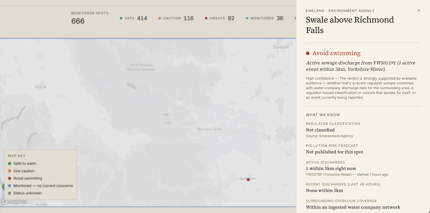
The Swale above Richmond Falls is a perfect example. Right now the map has it flagged unsafe: an active Yorkshire Water discharge roughly 300 metres upstream, logged in the last hour, with the Environment Agency record showing the spot not classified and no pollution forecast published for it. The regulator has nothing to say about the place; the discharge data says don't get in. That gap is the whole reason the map needed building - and because the feed updates every fifteen minutes, the verdict you see is tied to a moment. Click through an hour from now and it may well read differently, because the discharge will have stopped and the map will have moved with it. The regulators classify a bathing water once a year. The river changes faster than that.
That lag cuts the other way too. Pangbourne Meadow had no classification and no statutory monitoring when I built this, and the catchment data was already treating it as risky - a couple of weeks ago the Environment Agency designated it a bathing water, so the official record has now caught up to something the map was showing a month earlier.
I built the map in a couple of days with Claude Code. Next.js, Supabase, Mapbox. Check out the live version at swimmable.co.uk. Happy to collaborate with a UK charity, if there's interest.